Description
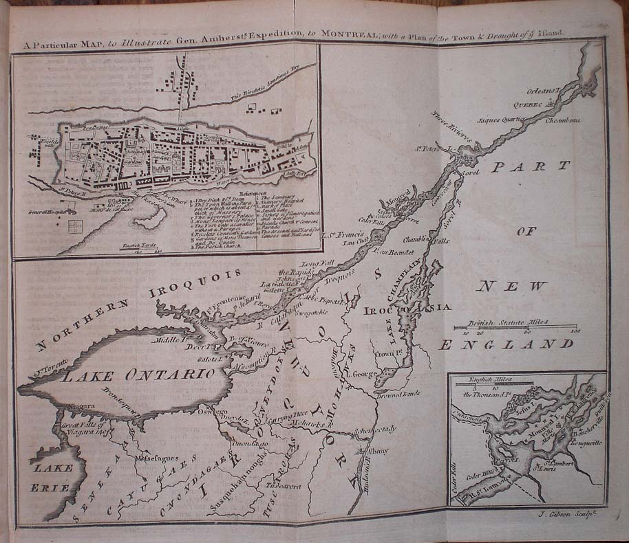
“A Particular Map, To Illustrate Gen. Amherst’s Expedition to Montreal; with a Plan of the Town & Draught of Ye Island”. Published in the “Gentleman’s Magazine”, London, 1760.
A very good map of the St. Lawrence River from Lake Ontario to Quebec City with two inset maps-one of the city of Montreal showing various public buildings, the other showing Montreal island. General Amherst led an attack on Montreal in 1760 leading to its fall. This French Indian War map is significant as it was published only one month after the fall of Montreal.
Map Condition: Bound in the original issue of the Gentleman’s Magazine. Light offsetting and small closed tear to upper fold but very good. Map Type: Copperplate engraving
Stock No: 1392
Cartographer: Gibson, John.
Year: 1760
Height (in): 7
Width (in): 10


