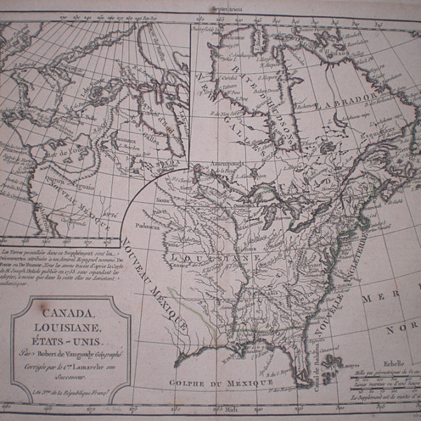
Description
Published in “Atlas Moderne, Seconde Partie”. Paris, 1782
A very good map of North America showing a huge apocryphal “Mer Ou Baye de L’Ouest” or Western Sea. Russian discoveries in the Aleutian Islands and the Behring Straits are shown. Updated from the 1762 edition. Phillips, P.L. (Atlases) 646-32; Sellers & Van Ee 93; Wagner-The Cartography of the Northwest Coast of America to the Year 1800, 599.
Map Condition: Laid down and margins a little browned but still a nice copy
Map Type: Copperplate engraved map with hand colouring
Stock No: 1410
Cartographer: Janvier, Jean
Year: 1782
Height (in): 12
Width (in): 17.5